Technology
New Satellite System Enhances Global Storm Tracking
New Satellite System Enhances Global Storm Tracking
In a significant leap forward for weather science, a new generation of satellite systems is revolutionizing the way the world monitors and responds to severe storms. Launched in early 2025 by a coalition of international space and meteorological agencies, the upgraded satellite network now provides unprecedented insight into the behavior of tropical cyclones, thunderstorms, and rapidly evolving weather systems. With advanced imaging, microwave sensing, and real time data integration, this system marks a turning point in global storm tracking capabilities offering earlier warnings, better forecasts, and ultimately, more lives saved.
1. The Next Era of Meteorological Satellites
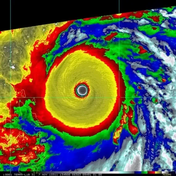
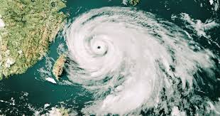
This latest satellite system represents a coordinated effort between agencies like NASA, NOAA, the European Space Agency (ESA), and regional institutions across Asia and South America. These satellites are equipped with advanced sensors that can penetrate clouds, detect minute changes in atmospheric moisture, and monitor wind speeds across vast oceanic expanses. One of the most revolutionary features is the ability to capture high resolution imagery every 30 seconds critical for tracking fast developing storms that form in previously “blind spots” over open water.
Unlike previous generations, these new satellites are positioned in both low Earth orbit (LEO) and geostationary orbit, creating a hybrid coverage model. The LEO satellites provide detailed vertical profiles of the atmosphere, while the geostationary ones continuously monitor fixed regions, enabling seamless real time observation of storm development. This dual layer system has already proven effective in early detection of tropical depressions in the Indian Ocean and Pacific basins.
2. Real Time Storm Intelligence for a Changing Climate
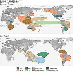
With climate change intensifying the frequency and severity of extreme weather events, having reliable real time data is no longer optional it’s essential. The new satellite system uses enhanced infrared and microwave sensors to detect temperature differentials and water vapor at multiple altitudes. This capability allows forecasters to monitor the internal structure of storms with greater accuracy, especially during periods of rapid intensification.
For instance, in June 2025, the system detected a low pressure system near the western Pacific that rapidly intensified into a Category 4 typhoon within 24 hours. The satellites captured critical indicators, such as increasing core temperature and eye wall symmetry, hours before these changes were visible on traditional radar. Thanks to this data, emergency response teams in Taiwan and the Philippines were able to issue early evacuation orders, potentially saving thousands of lives.
3. Ocean and Coastal Surveillance Breakthroughs
One of the most crucial advances lies in the system’s ability to monitor sea surface conditions and coastal storm surges. Using synthetic aperture radar (SAR) and scatterometer technology, the satellites can now detect wave height, sea surface roughness, and wind stress across storm affected oceans. This has proven invaluable in forecasting storm surges and coastal flooding, particularly in vulnerable delta regions like the Sundarbans in India and Bangladesh, or the low lying islands of the Caribbean.
In addition, the satellites are equipped to measure ocean heat content an important factor in determining the fuel available for storm growth. As storms pass over warm ocean currents, their intensity can spike dramatically. These real time measurements help scientists model such interactions more precisely, enabling better planning for storm related hazards like flash floods, landslides, and maritime emergencies.
4. Lightning, Wind Shear, and Precipitation Tracking
Another major innovation is the integration of lightning mapping and wind shear analysis. The geostationary satellites in the system are fitted with lightning sensors capable of detecting both cloud to ground and intra cloud strikes, providing early clues about storm maturation. A sudden increase in lightning activity can signal rapid strengthening or the formation of supercells within a thunderstorm complex.
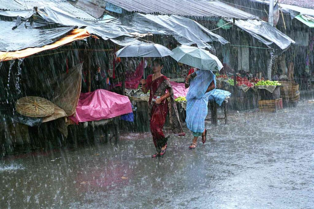
Coupled with wind shear detectors, these observations help forecasters evaluate storm sustainability and direction. For example, high wind shear can tear a tropical system apart before landfall, while low shear allows it to intensify. Precipitation radars onboard the satellites also provide high resolution rainfall estimates, which are crucial for flash flood warnings in mountainous and urban regions. These capabilities have already been successfully deployed in predicting sudden downpours in southern China and flash floods in parts of the U.S. Midwest during the current storm season.
5. Global Collaboration and Data Sharing
What sets this satellite initiative apart is its emphasis on international collaboration and open data sharing. Meteorological agencies around the world now have access to a shared, cloud based data repository where satellite information is streamed in real time. This fosters cooperation between countries and improves regional forecasting accuracy, especially in developing nations with limited ground based infrastructure.
For example, small island nations in the Pacific, often the first to face incoming cyclones, can now tap into satellite data for free, using pre built visualization dashboards. This not only enhances preparedness but also levels the playing field in climate adaptation. Joint simulation exercises conducted in 2025 among ASEAN member states, using satellite driven models, have already improved regional disaster readiness and coordination.
6. AI Integration and Predictive Modeling
To handle the massive volume of incoming data, the satellite system is integrated with artificial intelligence and machine learning algorithms. These tools analyze storm patterns in real time, identifying trends and anomalies that might be missed by human analysts. Predictive models, trained on decades of historical data and real time inputs, can now forecast storm tracks and intensities with up to 20% greater accuracy than traditional models.
In addition, machine learning helps identify precursors to storm formation, such as tropical waves or thermal anomalies, several days in advance. This extended lead time is invaluable for logistics planning, power grid stabilization, and humanitarian response. Private sector stakeholders like airlines, shipping companies, and insurance providers are already incorporating these AI driven forecasts into their risk management strategies.
7. Looking Ahead Resilience in a Stormier Future
As global weather patterns grow more volatile, the importance of accurate and timely storm tracking cannot be overstated. The 2025 launch of this new satellite system marks a critical milestone in humanity’s effort to adapt to a changing climate. While no technology can prevent storms, better forecasting can save lives, reduce economic losses, and improve long term resilience.
The challenge now lies in ensuring that this powerful data infrastructure remains funded, updated, and accessible to those who need it most. Continued investment in space based Earth observation, combined with strong global cooperation, is essential for building a safer, more informed future. As we face a future of rising seas, hotter oceans, and stronger storms, this satellite system stands as a symbol of innovation meeting necessity and of science working in service of survival.